
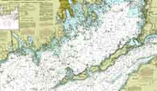
Nautical Maps are used to navigate the waters. They typically show major land formations, and have numbers throughout the waters to show depths. Modern ones often show markers, buoies, good spots for anchoring, and other such maritime information. This chart also has isolines to show similarities in depths.
No comments:
Post a Comment