skip to main
|
skip to sidebar
Thursday, April 22, 2010
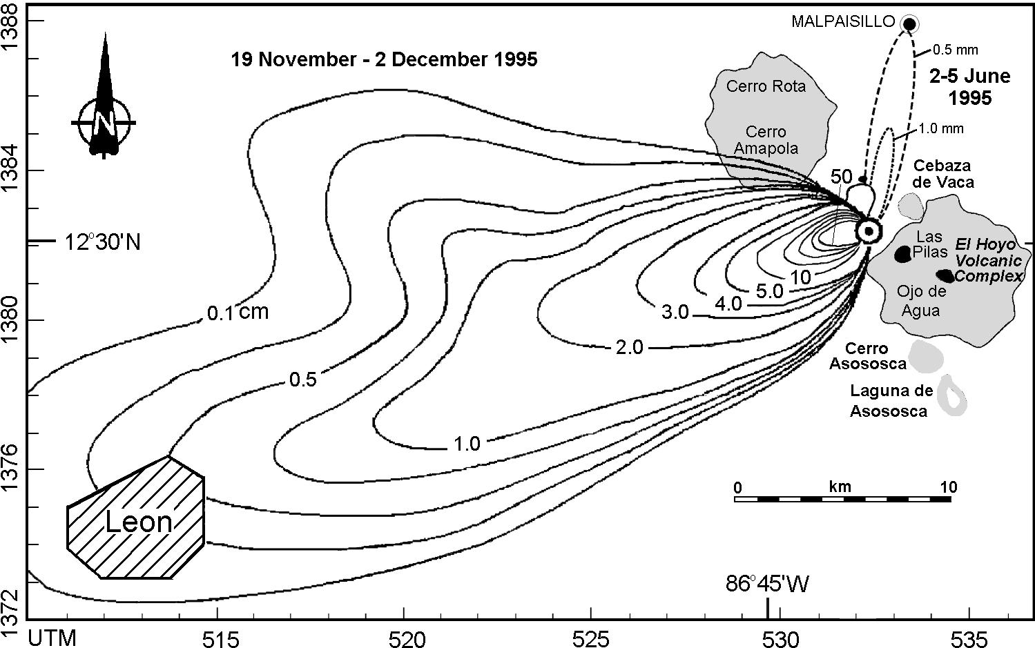
Isopachs
http://www.geo.mtu.edu/volcanoes/central_america/nicaragua/cerro_negro/gvn/images/2012neg4.jpg
Isopach maps use contour lines to show variations in thickness. This maps shows variations in thickness of ash falling from the volcano Cerro Negro.
No comments:
Post a Comment
Newer Post
Older Post
Home
Subscribe to:
Post Comments (Atom)
Map Catalog GIS3015klp04e
Followers
Blog Archive
▼
2010
(54)
▼
April
(48)
Thermal Map
Nautical Map
Handgun Shooting Symptom Chart
Mind Map
Mental Map
Star Plot
Isoline Map
Football Play Diagrams
Family Pedigree
Family Tree
Gel Electrophoresis Diagram
Star Maps
Pictograms
Pie Graph
Scatterplot
Venn Diagrams
Bubble Maps
Windrose
Population Profiles
Box Plot
Resource Maps
Cartographic Animations
Parellel Coordinate Graph
Planimetric Map
Stem & Leaf Plot
Doppler Radar
Hypsometric Maps
Classed Choropleth Map
Range Graded Proportional Circle Map
DEM
Dot Distribution Map
Prism Maps
Cartogram
Bilateral Graph
DOQQ
Ifrared Arial Photo
Black and white arial photography
Climograph
LADAR
Triangular Plot
Coorelation Matrix
Similarity Matrix
Flow Charts
Histogram
Isopachs
Isohyets
Isobars
Isotachs
►
February
(1)
►
January
(5)
About Me
klp04e
View my complete profile
No comments:
Post a Comment